Kununurra Tourist Attractions and Sights
Things To See And Do In And Around Kununurra
Kununurra has a lot to offer, no matter what you are interested in.
Fishing, swimming, nature, Aboriginal art, boat cruises, canoeing, caving and abseiling, four wheel driving, hiking...
A range of industries is situated in the valley and nearby. Several of the businesses offer tours and insights into their operations. Even jobs, if you want to stay.
And after seeing the region, you might just want to stay...

I'll start off with things to see and do in the town itself, then I'll cover what's nearby, and on the next pages I'll tell you where to go for a swim, and about all the day trips you can do from Kununurra.
Kununurra Attractions - Town Area
Probably the best starting point is Kununurra's Visitor Centre at 75 Coolibah Drive. The friendly staff have answers to all your questions, and a huge range of maps, brochures and detailed information on absolutely everything that might interest tourists.
To get a good overview of the area climb up Kelly's Knob.

Actually, you can drive most of the way. Only the last bit is a rocky path with steps and handrails, all the way up to the lookout at 191 metres height. From up here you have great views of the town, the irrigation areas and farmlands, the Diversion Dam, Kununurra airport, the nearby ranges and the lake.
Come to think of it, Kelly's Knob is probably the best place to finish a day's sight seeing... Grab some cheese and wine before you go to enjoy the sunset. (In case you didn't know, Kununurra has the best sunsets in Australia.)
If you are interested in the irrigation project, its history and other regional history, visit the Kununurra Museum (Coolibah Dr.)
Kununurra has several art galleries. Artopia Gallery is located on Konkerberry Dr. and has a range of works of local artists. For Aboriginal art try Artlandish Aboriginal Art Gallery (Papuana St.) and of course the well known Waringarri Aboriginal Arts (opposite Kelly's Knob).
Waringarri was the first indigenous owned art centre to be established in the Kimberley and is one of the oldest in Australia. The centre also offers a range of cultural tours and performances.
Two more galleries worth visiting (and great for buying gifts for people back home) are Birdland Functional Art and Kimberley Boab Creations, both in Poincettia Way.
If you'd rather look at diamonds then Kununurra, being so close to the Argyle Diamond Mine, is of course the best place to be. Kimberley Fine Diamonds near the shopping centre (yes, we have a shopping centre) has one of Australia's biggest selections of coloured diamonds, including pink diamonds. Those are so rare that most people will probably never see one. The Argyle mine is the only mine in the world that produces them.
Another place to browse and shop for diamonds is Nina's Jewellery inside the shopping centre.
The best place for Kimberley rock art, including the rare zebra rock, is Mick Long's Rockalong (Bandicoot Drive). Longy, as we call him, has by far the biggest and bestest range of absolutely stunning pieces made from several types of local rock that he mines himself.
You can also find his creations, and loads of other stuff, including fresh, locally grown fruit and vegetables, at the Kununura Markets...

The markets are held 8am - 1pm every Saturday during the dry season in Whitegum Park. (Which is, like everything else in Kununurra, near the town centre.)
Kununurra - Attractions Near Town
South Of Kununurra
The Ord River Diversion Dam is located on the main highway, six kilometres west of Kununurra.
Above the dam you find Lake Kununurra, which is popular for swimming, boating and water skiing.
You can join a boat tour to cruise up the river to the main dam at Lake Argyle, take a sunset cruise, or you can paddle a canoe form the main dam back to Kununurra (but that's an overnight trip).

If you want to launch your own boat use the boat ramp near Kimberleyland Caravan Park entrance (on the highway, at the edge of town).
Below the dam is the Lions Park boat ramp where you can launch your dinghy. And if you are a fisherman you will. Bandicoot Bar, the rocks just below the dam, are a top spot for barramundi fishing.

So is the mouth of the Dunham River, which joins the Ord River just a little bit below the boat ramp.
(Don't even think about swimming anywhere below the dam! You'll end up as croc dinner for sure.)
If you cross the dam and take the next road to your left you find yourself on the Packsaddle Plains, one of the main farming areas. As you drive along you will notice a sandalwood plantation, mango orchards, citrus, melons and more.
Nine kilometres along that road is the welcoming Zebra Rock Gallery. They do exhibit and sell Zebra Rock, but the Zebra Rock Gallery is also a nice place to visit and have a cuppa, a mango smoothie or mango cheesecake, or a cool drink in their garden. If you have kids go down to their jetty and hand feed the hundreds of catfish waiting there.
Another reason to drive out that way is the Sleeping Buddha or Elephant Rock, a big rock formation on Lake Kununurra. (The official name is Carlton Ridge.) It looks most like a sleeping buddha if viewed from town, but if you want to see the elephant you have to cruise up the river or drive along Packsaddle Road.
North Of Kununurra
Ivanhoe Road crosses more farmland. A turn off to the left takes you to River Farm Road, a picturesque area on the lower Ord River. If you are rich you can buy yourself a million dollar mansion with river frontage here.
For a lunch stop visit the popular Ivanhoe Cafe at Ivanhoe Farms (just out of town on Ivanhoe Road).
Ivanhoe Crossing is the place where Ivanhoe Road crosses the Ord River. This used to be the main and only road to Wyndham in the old days...


The crossing is another great place to try for barramundi. (It's also a great place to collect free lures that the tourists lost on all the snags there, hehe.)
The crossing will be impassable during the wet season and for a while after. Once you can drive across again it also becomes a popular spot for locals to sit in the natural spas below the crossing with a cold beer on a hot afternoon. You're welcome to join us. (Don't venture away from the shallows and the white water though. Big crocodiles live in this river!!)

Driving across is neither dangerous nor
difficult once the water has dropped enough, but this is a wide
crossing with a strong current, so driving across may not be the best
thing to do to your wheel bearings.
On the way back to town from the crossing you can turn left from Ivanhoe Road onto Research Station Road, past the Frank Wise Institute (research institution of the Department of Agriculture, no tours, but welcomes visitors), to get to Weaber Plains Road. Weaber Plains is the third main irrigation and farming area of Kununurra.
Kununurra legend Spike Dessert’s Hoochery, about 15 km out of town, is a must stop. It is WA’s only licensed distillery, producing the highly decorated Ord River Rum and other spirits from locally grown cane. You can tour the distillery and sample and buy their range of products, as well as sit down inside or in the beer garden for lunch or tea, coffee and (rum-)cake.
(Sadly, Spike Dessert passed away Dec 13, 2017. For an inspiring read about the life of this larger than life character as well as the history of the Hoochery, see this article in the Kimberley Echo.)
Nearby is the new Sandalwood Factory. Though called factory it's actually a showroom where you can learn more about the sandalwood farming and processing going on in the valley.
The City Of Ruins is just four
kilometres out of town. It's an area of unusual
sandstone formations that are supposed to resemble the remains of an
ancient city. I can't see a city but it's a nice area nevertheless,
great for bushwalking, especially in the afternoons when the rocks
glow in their most intense colours...

Make sure you have the time to walk far enough out the back. If you manage to find a way up to the top you will be rewarded with some great views...

East Of Kununurra
And then, last but certainly not least, there is Mirima National Park, also called Hidden Valley. The small park is just two kilometres out of town. If you want to drive your car in you have to pay a fee, but you can leave the car outside the gate and take the foot path. It's a beautiful walk through a narrow valley and not far at all. As I said, it's a small park.

The sandstone formations here are part of the same range as the City Of Ruins, but are much bigger and more impressive.

They resemble the domes of the famous Bungle Bungles (Purnululu National Park), which is why they are sometimes called Mini Bungle Bungles.

Near the parking area inside the park is an information bay, a picnic shelter and a map that explains the three other short walks that start from there.
Hidden Valley is
particularly beautiful in the afternoon when the low sun makes the
rocks glow. But don't leave it too late or most of the valleys will
be in deep shade.

South-East Of Kununurra
Let me think. Well, there's the rubbish tip...
Actually, Lake Argyle is south-east of Kununurra, but I feel that belongs on the page with day trips from Kununurra.
Next page: Day Tours from Kununurra
Read about other Kimberley Towns
Travelling to the Kimberley?
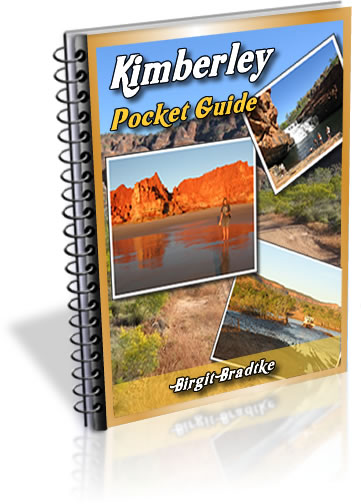
The FREE Kimberley Pocket Guide
A great introduction to travel in the Kimberley region and along the Gibb. This free resource will answer all the questions you might have in the early stages of planning a trip.
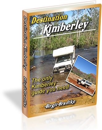
Destination Kimberley
The full Kimberley travel guide shows you how to make the most of your adventure at Australia's last frontier. Destination Kimberley includes the most detailed and most current guide to the Gibb River Road available anywhere. Also called "The Bible" by its readers.
Travelling to the Northern Territory?
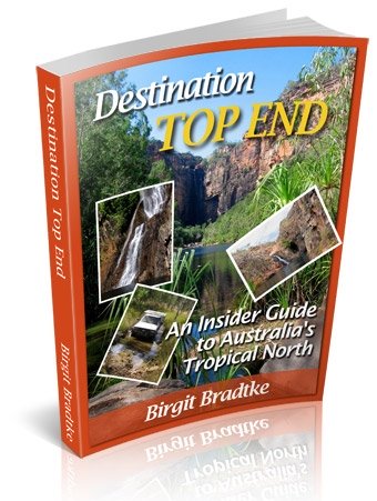
Destination Top End offers the same comprehensive, detailed insider information for the tropical regions of the Northern Territory. Be the best informed traveller in the Kakadu, Litchfield and Katherine Gorge national parks and beyond!
A must have if you travel to or from Darwin.
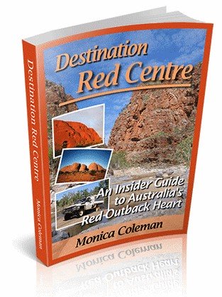
NEW! Destination Red Centre is the latest addition in this popular series. Monica Coleman takes you through Australia's red Outback heart, offering all the detail and insider tips that you have come to know and love about our guides. With special emphasis on Aboriginal communities and culture.
A must have if you travel to or from Alice Springs/Uluru.
Thanks for visiting! Have you
requested your free guide book yet?
I offer a free guide to the Kimberley plus a free, very popular newsletter.
If you plan to visit the Kimberley, you can't afford to miss either.
Don't believe me? Learn more about the free pocket guide here and see the newsletter archives here.
Next page: Day Tours from Kununurra
Read about other Kimberley Towns
SUBSCRIBE ABOVE TO RECEIVE YOUR FREE KIMBERLEY POCKET GUIDE!
DESTINATION KIMBERLEY, ALSO KNOWN AS "THE BIBLE".
DESTINATION TOP END, YOU NEED THIS IF YOU ARE TRAVELLING TO OR FROM DARWIN
DESTINATION RED CENTRE, THE LATEST ADDITION TO THIS POPULAR SERIES, COVERS THE OUTBACK AROUND ALICE SPRINGS AND ULURU