Gibb River Road Pictures
Kimberley Photo Gallery
Many myths revolve around the Gibb River Road in the Kimberley. Some are true, some aren't.
Read on to find out what's true and what isn't...

True is that the corrugations are sometimes deep enough to lie in.
Not true is that you are on your own out here, that the drive is challenging, that you need to be an experienced four wheel driver, yada, yada, yada.
The exception is the very beginning of the tourist season, when the road re-opens after the wet season closure.
Before the graders have done their bit, when the rivers and creeks still run deep and fast, then it can indeed be a real adventure.
However, also not true is that you will experience the solitude of an untouched wilderness. Those days are over.
True is that it is still a great trip. So fear not, pack up your four wheel drive and go. The tourist numbers here will only increase...
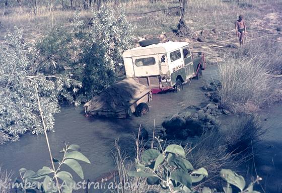 The Gibb River Road in 1968. © Photo by reader Gary.
Gibb River Road Pictures
Typical Views Of The Gibb River Road
Let's start off with some typical photos of what the Gibb River Road looks like...
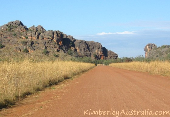
The above picture shows the usually very well maintained western part of the road, not too far from Derby. To the right of the road you may notice a rock feature called "Victoria's Head".
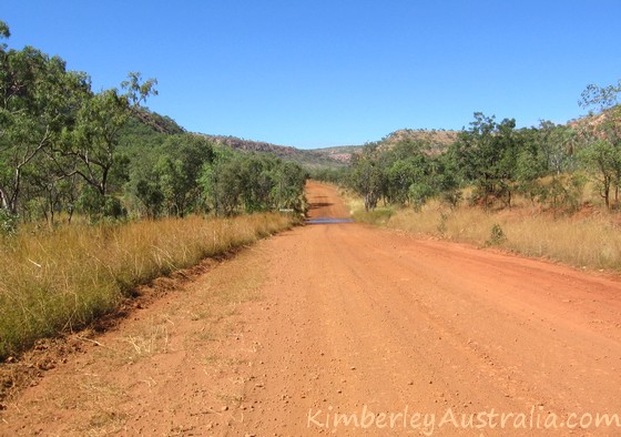
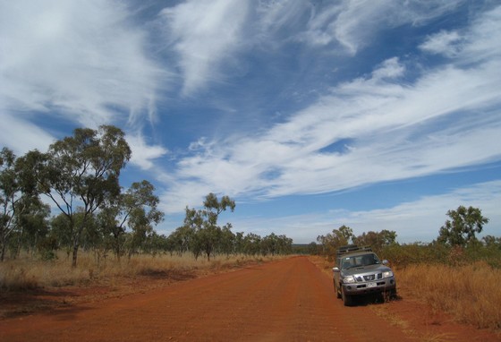
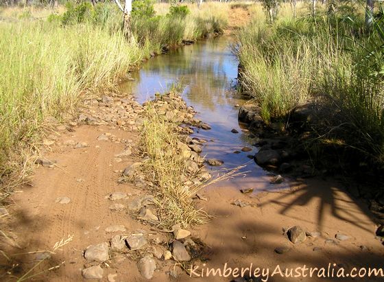
This again is a very typical view of the Gibb River Road. Most of the road consists of red dirt and gravel. Parts of it can get badly corrugated. This stretch was reasonable.
There is still a puddle left from one of the creeks, but it is very early in the season. Most people will not see much water at all on their trip.
 No big deal at all. © Photo by reader Arnold
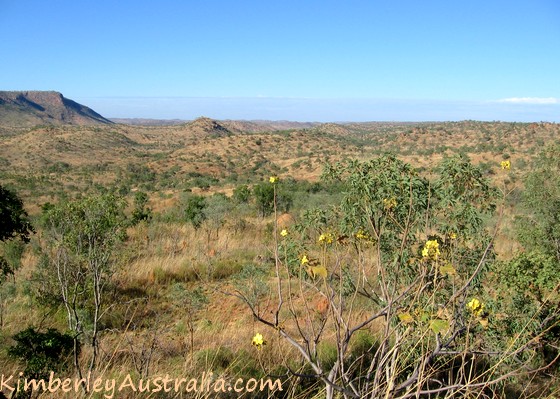
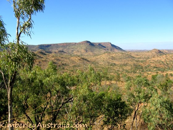
The scenery is varied. There are some open flat stretches, but a lot of the time the road winds its way through and climbs over the many ranges that characterise the Kimberley Plateau.
 © Photo by reader Maurice
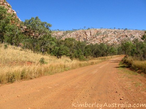
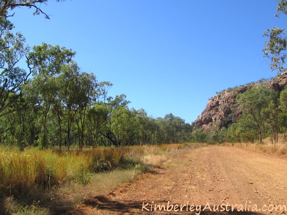
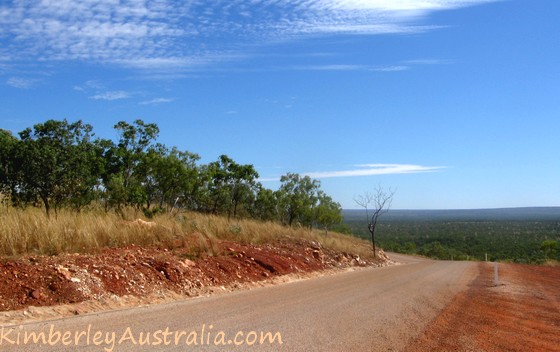
Wherever those hills are steeper the road has been sealed to avoid the bad washouts that adventurers had to deal with in the old days.
Here is a particularly scenic stretch of road, you can see parts of the sealed road on the right.
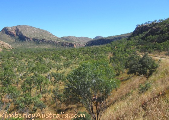
The picture below shows clearer that the road is in fact sealed. It also hints at another aspect of those higher parts of the road...
...namely the sweeping views...
Getting Sidetracked
Now for all those people who always email me to ask, "Do I really need a 4WD to do the Gibb River Road?"
Well, if all you want to do is "do" the Gibb , so you can say you have "done" it, and if what you mean by that is drive across from one end to the other, then no, at the right time of the year you can probably do that in any car. But what's the point? All the attractions along the Gibb are found on side tracks.
(If you came here to see pictures of those attractions rather than the main road, see the pages about the gorges, the stations, and other pages linked from the main Gibb River Road page.)
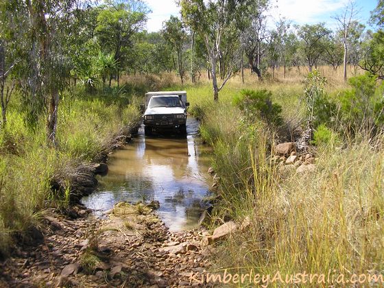
So here is a little sampling of what you might find along those side tracks off the Gibb...
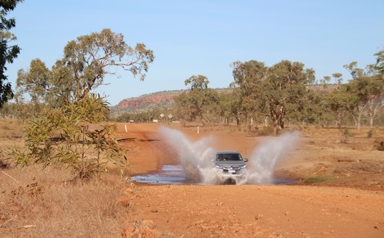
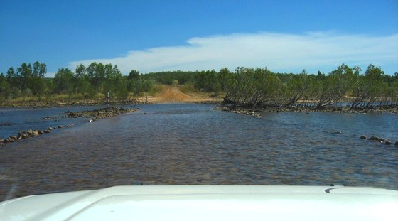
Not only are those tracks much narrower. Early in the season there may be water on the road in many places. And the tracks can be a lot rockier than the main road.
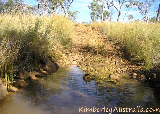
 On the way to Adcock Gorge
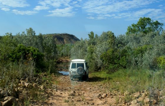 © Photo by reader René
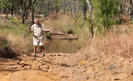 Driving into Adcock Gorge. © Photo by reader Arnold
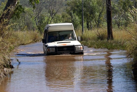 © Photo by reader René
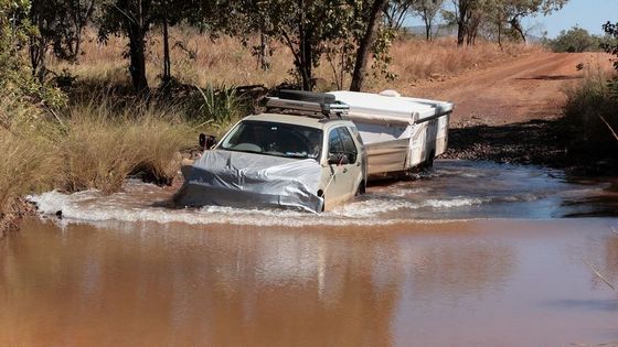 The way into Bell Gorge. © Photo by reader Swanny
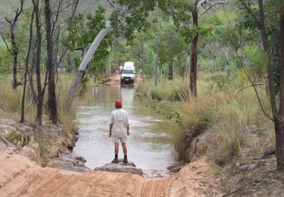 The way into El Questro Gorge. © Photo by reader Scott
And that is the reason why in my eyes it doesn't make sense to drive the Gibb River Road in a conventional vehicle. Even once all the water has dried up, many of the side tracks remain very rough and you are much better off with the clearance of a four wheel drive vehicle. (You don't need exceptional skills, just a vehicle with clearance.)
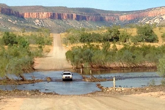
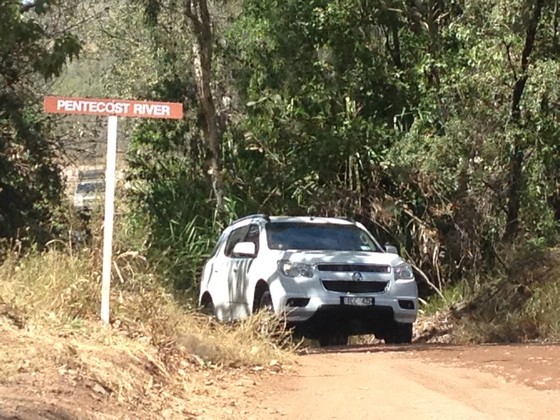
Pentecost River Crossing
This is probably the most famous of all Gibb River Road photos:
The Pentecost River Crossing and the Cockburn Ranges at sunset.
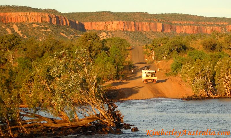
The Pentecost River is one of the few big rivers that you have to cross on your trip and at the very beginning of the season that can be a bit of a challenge.
If you want to see the Cockburn Ranges glow in intense colours as in the photo above, then you need to be here right at sunset. Just a little bit earlier and the landscape will look more like in the reader photo below. (Still impressive though!)
 © Photo by reader Valerie
And if you get here early in the day with the sun still on the other side of the range, then there will be no sun on the rock faces at all...
 © Photo by reader Joe
As a side note: In all the above photos you can again see that the road is sealed where it gets steeper in the back.
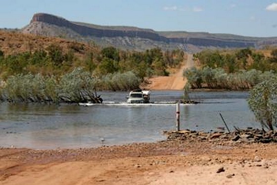
All the above photos were taken while standing on the western side of the crossing, looking east.
Crossing the river from east to west looks less impressive, something like this:
 © Photo by reader Jean-Daniel
Does not look too difficult, does it? And it isn't. The Pentecost crossing is only a problem very early in the season when it is first opened. Then the water may still be well over 500 mm deep. But give it two weeks and all will be well.
Even motorcycles can cross it...
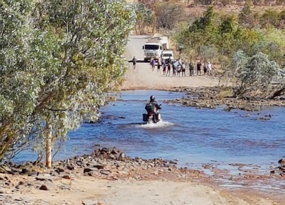 © Photo by reader Helen
By the way, the Gibb River Road is not the only road that crosses the Pentecost. If you drive into El Questro Station you will need to cross the river again. This crossing is shorter, narrower, and the entrance and exit are steeper. (You can only guess it in the photo below.)
Just like the main crossing, this one can be quite the adventure just after the wet season!
 © Photo by reader Valerie
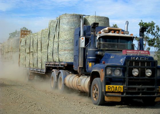
Road Trains
Road trains are looooong trucks with three, four or more trailers. By the time you get here you will have seen many of them on the highways. But they don't kick up as much dust on the highways...
 © Photo by reader Maurice
The Gibb River Road is an important beef road and you will come across many cattle trucks. All road trains drive fast and it's not easy for them to slow down, so please don't do stupid things like pull out in front of them or similar.

Also, road trains kick up dust. A LOT of dust...

Meeting them like this is not too bad. You just pull off the road, stop, and wait till the dust settles. But it's not much fun being stuck behind one and you can imagine your chances of seeing the road ahead. Overtaking them is usually not an option.
It's best to have a break instead.
Roadhouses
Getting fuel and supplies on the Gibb River Road is not a problem any more. These days there are three roadhouses along the main road. From west to east those are Imintji (about 230 km in), Mt. Barnett (305 km) and Gibb River (370 km).
 An older photo of Imintji Roadhouse
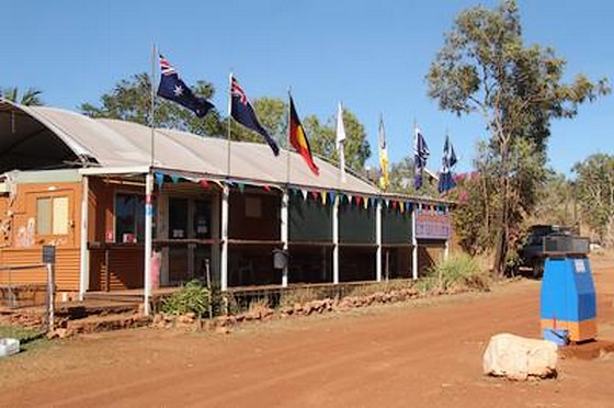 Imintji Roadhouse in 2017. © Photo by reader Arnold
 Mt. Barnett Roadhouse
And this is all I can think of when it comes to showing you the Gibb River Road.
Of course, the main road itself is not what most people come here for and you likely want to see pictures of the many gorges, waterfalls and other attractions along it. So here goes...
The most well known places, again from west to east, are Windjana Gorge and Tunnel Creek, Bell Gorge, Mornington Wilderness Camp and Manning Gorge. (And of course the two huge, more commercialised properties Home Valley and El Questro.)
To see many more photos of many more gorges, waterfalls and stations along the Gibb see the page about Kimberley gorges, about the stations along the Gibb, or simply start at the main Gibb River Road page.
More Kimberley Photos:
- Kimberley Pictures, On The Road
- Kimberley Pictures, In The Air
- The Bungle Bungles
- The Mitchell Falls
- Lake Argyle
- Cable Beach, Broome
Travelling to the Kimberley?
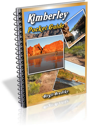
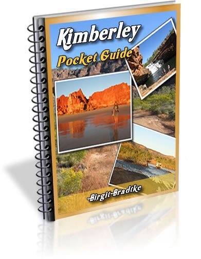
The FREE Kimberley Pocket Guide
A great introduction to travel in the Kimberley region and along the Gibb. This free resource will answer all the questions you might have in the early stages of planning a trip.
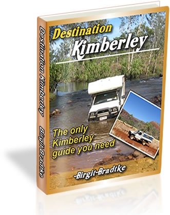
Destination Kimberley
The full Kimberley travel guide shows you how to make the most of your adventure at Australia's last frontier. Destination Kimberley includes the most detailed and most current guide to the Gibb River Road available anywhere. Also called "The Bible" by its readers.
Travelling to the Northern Territory?
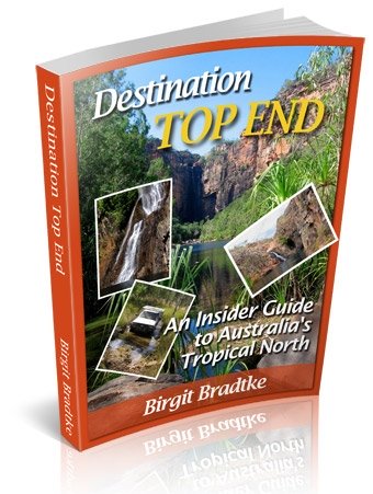
Destination Top End offers the same comprehensive, detailed insider information for the tropical regions of the Northern Territory. Be the best informed traveller in the Kakadu, Litchfield and Katherine Gorge national parks and beyond!
A must have if you travel to or from Darwin.
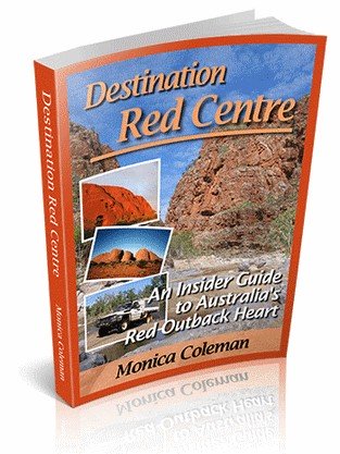
NEW! Destination Red Centre is the latest addition in this popular series. Monica Coleman takes you through Australia's red Outback heart, offering all the detail and insider tips that you have come to know and love about our guides. With special emphasis on Aboriginal communities and culture.
A must have if you travel to or from Alice Springs/Uluru.
Thanks for visiting! Have you
requested your free guide book yet?
I offer a free guide to the Kimberley plus a free, very popular newsletter.
If you plan to visit the Kimberley, you can't afford to miss either.
Don't believe me? Learn more about the free pocket guide here and see the newsletter archives here.
Read more about the Gibb River Road.
More Kimberley Photos:
SUBSCRIBE ABOVE TO RECEIVE YOUR FREE KIMBERLEY POCKET GUIDE!
DESTINATION KIMBERLEY, ALSO KNOWN AS "THE BIBLE".
DESTINATION TOP END, YOU NEED THIS IF YOU ARE TRAVELLING TO OR FROM DARWIN
DESTINATION RED CENTRE, THE LATEST ADDITION TO THIS POPULAR SERIES, COVERS THE OUTBACK AROUND ALICE SPRINGS AND ULURU